

MapMyShore
Since the 1970s, the Virginia Institute of Marine Science (VIMS) has developed Shoreline and Tidal Marsh Inventories to document tidal shoreline conditions and support informed management decisions.
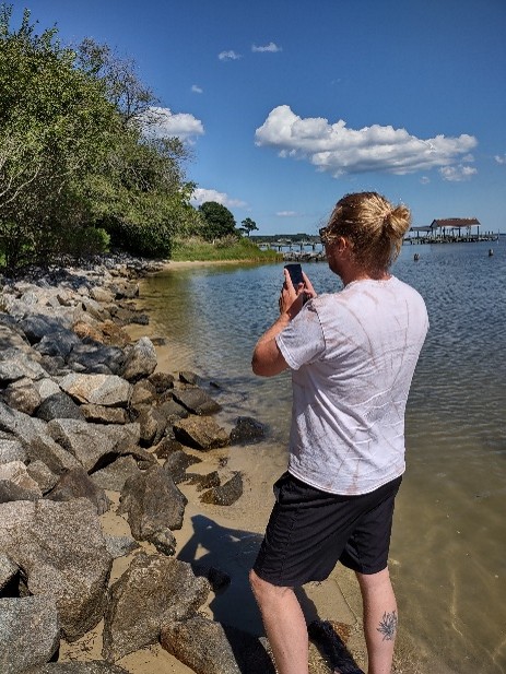
MapMyShore, a mobile App, builds on this work by enabling community members to contribute observations with their smartphones. These contributions help to update and validate existing assessments, including those derived from remote sensing models, while also highlighting natural resources and culturally significant sites valued by local stakeholders.
By combining scientific and community knowledge, the tool fosters engagement, raises awareness of hazards and resiliency challenges, and empowers residents to play an active role in shaping the future of Virginia’s coastal environments.
Get started now!
This project is being conducted by the Center for Coastal Resources Management at the Virginia Institute of Marine Science (VIMS) in partnership with the Northern Neck Planning District Commission (NNPDC). This project is funded by the National Oceanic and Atmospheric Administration (NOAA) - Virginia Coastal Zone Management Program (VA-CZMP). Grant# NA 23NOS4190255.