New Center of Excellence in Environmental Forecasting advances coastal resilience efforts
 A new Center of Excellence in Environmental Forecasting (CEEF) has been established at William & Mary’s Batten School of Coastal & Marine Sciences & VIMS. The Center will turn long-term datasets, environmental sensors and advanced computer modeling into user-friendly forecasting tools that enhance coastal resilience and inform daily decision-making across Virginia and beyond.
“Environmental forecasting is a core strength of the Batten School & VIMS, grounded in decades of coastal data collection, advanced numerical modeling and applied research,” said Batten School Dean and VIMS Director Derek Aday. “This new Center will expand the reach, usability and impact of our expertise for the benefit of communities across the commonwealth and beyond.”
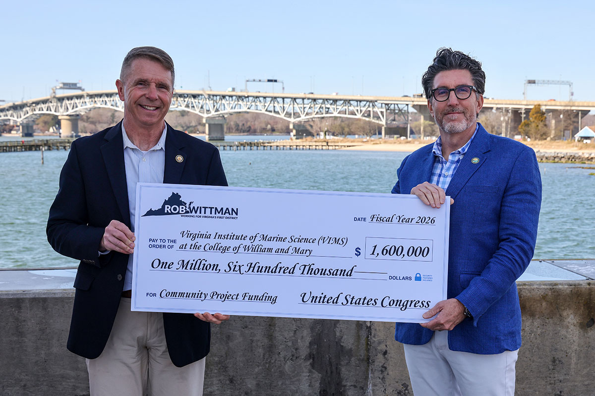
On March 13, U.S. Rep. Rob Wittman visited the Gloucester Point campus and presented Aday with a ceremonial check for $1.6 million, representing federal funds he secured in support of the Center. CEEF received strong bipartisan support from federal legislators, and it has also received backing from state representatives. Signaling an ongoing need for enhanced environmental forecasting capabilities, Virginia has allocated more than $800,000 toward CEEF.
"I am thrilled to deliver my $1.6 million funding request for the VIMS Center of Excellence in Environmental Forecasting,” said Wittman. “Forecasting is one of the most important ways we translate environmental data into useful tools — bringing together data from many sources and turning it into information that scientists, communities and policymakers use to make critical decisions. Whether it’s protecting the public, managing marine resources, or strengthening coastal resilience, this funding and the Center they support will allow us to take that work a step further.”
 Turning data into decisions
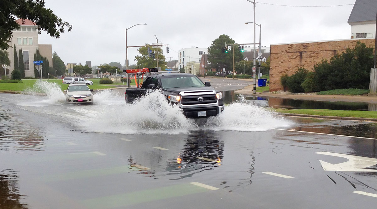
Anyone who has driven through Norfolk, Virginia, during heavy rainfall or a particularly strong tidal cycle has likely run into flooded roads. What they might not know is that the alerts they get on the Waze app are there in part because of a collaboration that started when Derek Loftis was a student at the Batten School & VIMS.
“We were actually the first city in the world to establish a feed to Waze of flooding model data that uses water level sensors and other data sources to automatically alert users of flooded roads — that’s all thanks to the collaboration that started with Derek and VIMS,” said Kyle Spencer, Norfolk’s chief resilience officer. “To this day, every time someone interacts with one of those alerts I get real-time feedback that the data feed is working.”
Norfolk was one of several municipalities to collaborate with Loftis, now an assistant professor at the Center for Coastal Resources Management (CCRM) at the Batten School & VIMS, on the installation of low-cost water level sensors in flood-prone areas around Hampton Roads. The project laid the groundwork for the development of StormSense, a data product designed to monitor and forecast regional flooding issues.
“We use TideWatch and StormSense for emergency planning purposes. We’ve also used SCHISM to model things like water quality impacts when planning a large-scale coastal protection system,” said Spencer. “That’s a multi-billion-dollar project that we’re just getting started on, and the inundation modeling through SCHISM was part of the report that helped get it authorized by Congress and secure some initial funding.”
SCHISM (Semi-implicit Cross-scale Hydroscience Integrated System Model) is an advanced hydrodynamical modeling system developed by Professor Joseph Zhang at the Batten School & VIMS CCRM. The open-source modeling platform is used by researchers and government agencies throughout the world, including the Environmental Protection Agency and the National Oceanic and Atmospheric Administration. It simulates how water moves across landscapes and through estuaries, enabling forecasts of tidal flooding, storm surge, runoff and water-quality changes.
“SCHISM serves as the engine for much of the environmental modeling work being performed at the Batten School & VIMS,” said Zhang. “The resolution of the model can be adjusted based on the need and available computing power, allowing it to provide pinpoint analyses for collaborators while incorporating all relevant spatial scales.”
The same modeling capabilities also power tools used by agencies across the commonwealth. For example, CCRM collaborates with the Virginia Department of Transportation (VDOT) to model how flooding could affect road networks from the present day through the end of the century, identifying road segments at risk and informing both emergency response and long-term planning strategies.
“The project involved a comprehensive assessment of VDOT and local road networks within flood hazard zones identified by the Federal Emergency Management Agency. We extended that analysis to look at the impact of flooding on road accessibility at any flood level,” said CCRM Director Kirk Havens. “Using that information, we developed a tool that can help support state decision-making in relation to transportation infrastructure as well as species habitat management in response to tidal flooding and rising sea levels.”
From forecasting Chesapeake Bay conditions to predicting sea level rise
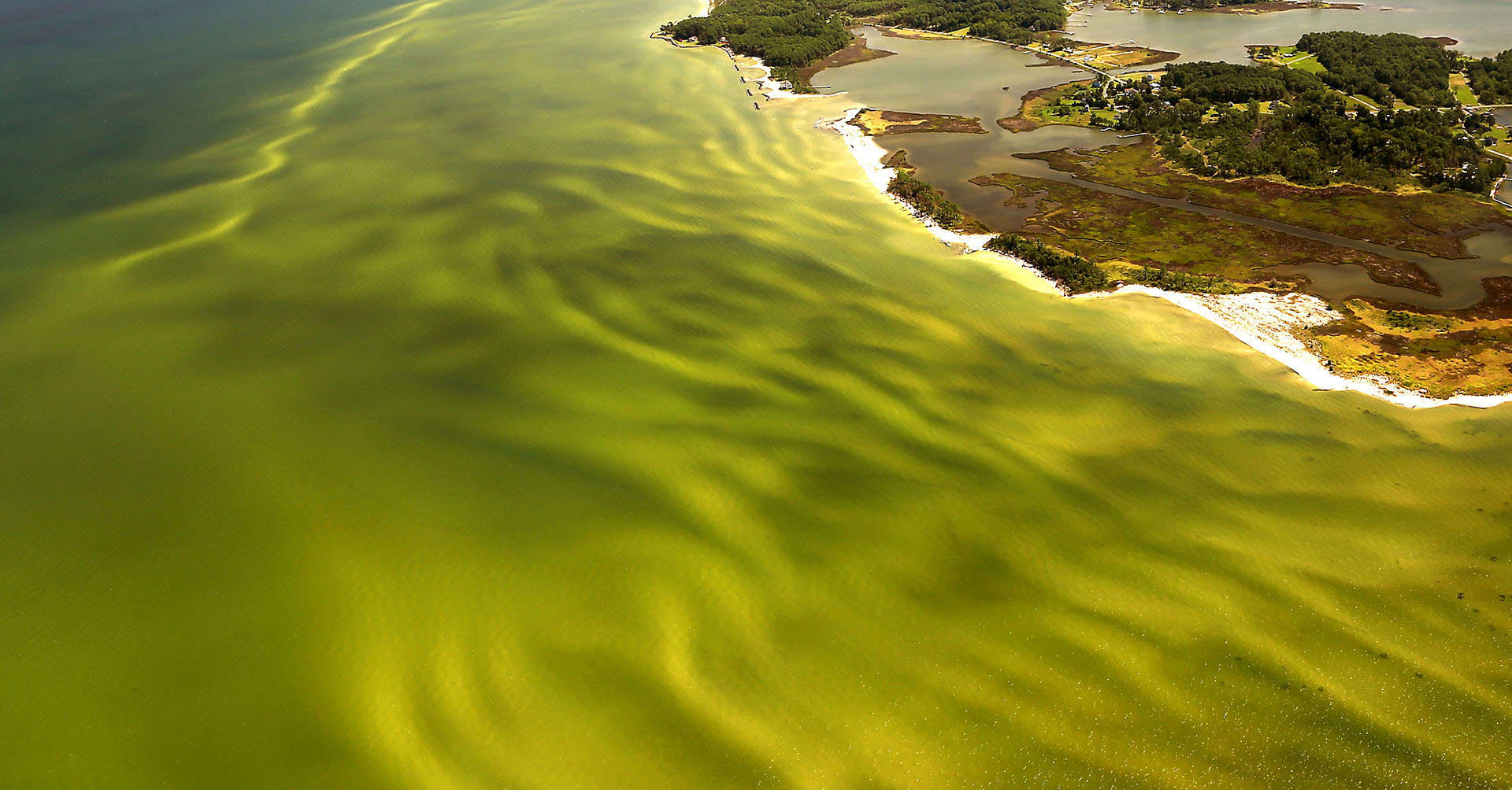
For many people, Batten School & VIMS data products help guide everyday decisions on the Chesapeake Bay — from planning a day on the water to managing aquaculture operations or deciding whether conditions are safe for swimming. These insights are powered by the Chesapeake Bay Environmental Forecasting System (CBEFS), which integrates hydrodynamic and biogeochemical models with real-time observations to provide users with a five-day forecast of Bay conditions. The system is one of the few in the U.S. that provides operational forecasts of both physical and ecological conditions across an entire estuary.
“I pull up CBEFS every night or morning before I take people fishing,” said Captain Walt, whose business, Light Tackle Charters, offers guided fishing trips on the Chesapeake Bay. “I look at dissolved oxygen levels, harmful algal blooms, and turbidity and, using those three variables combined with the weather forecast, I can pretty much tell you where the fish are going to be in a 12-hour window.”
CBEFS produces forecasts of conditions such as temperature, salinity, dissolved oxygen, pH, turbidity, harmful algal bloom risk and sea nettle presence. This information is used by anglers, aquaculture growers, coastal managers and the public.
The same forecasting framework also supports widely used environmental report cards produced by Batten School & VIMS scientists, including the Chesapeake Bay Dead Zone Report Cards, which provide seasonal summaries of low-oxygen conditions and help environmental managers track a key indicator of Bay health. Funding supporting CEEF will allow scientists to expand these tools to include acidification report cards and forecasts of habitat conditions for species such as striped bass, providing new environmental data to help communities and industries anticipate changing conditions in the Bay.
Sea Level Report Cards are another widely used data product that combine long-term data from tidal gauges at 36 U.S. localities and statistical analyses to predict future sea levels and show the processes affecting them. The interactive dashboard and its data are used by communities across the nation to understand and plan for future regional changes in sea levels.
Coastal Virginia residents also have access to TideWatch, which allows users to view up to a three-day forecast of water levels using either the interactive TideWatch Maps platform or the more static TideWatch Charts. TideWatch can help communities and residents anticipate future flooding scenarios or simply track tidal conditions for business or recreation.
“Our goal with products like TideWatch and Sea Level Report Cards is to connect rigorous science with real-world decision-making,” said Batten School & VIMS CCRM Assistant Professor Molly Mitchell. “We want to give coastal communities the tools they need to respond to near-term risks as well as the ability to plan thoughtfully for the decades ahead.”
Developing the infrastructure behind the forecasts
A significant portion of CEEF funding will support high-performance computing resources at William & Mary. These investments will allow researchers to run higher-resolution models, process larger datasets and scale existing tools for broader public use.
Additional funds will support improvements to existing platforms and the development of new web-based tools, informed by public research and user-experience testing to ensure accessibility and usability.
“The combination of expertise and our state advisory mandate uniquely position the Batten School & VIMS to lead not just our region but our nation in environmental modeling and the development of new tools to help coastal communities and businesses adapt to a rapidly changing world,” Aday said. “We will steward these investments for the benefit of the public to enhance our ongoing efforts to help build and maintain resilient coastal communities.”
As coastal populations grow and environmental conditions become more dynamic, forecasting tools are increasingly central to infrastructure planning, emergency response, commerce and recreation. With CEEF, the Batten School & VIMS are building on decades of expertise to ensure that the science guiding those decisions is accessible, scalable and ready for the future.
More information about CEEF and available data products can be found at vims.edu/ceef.