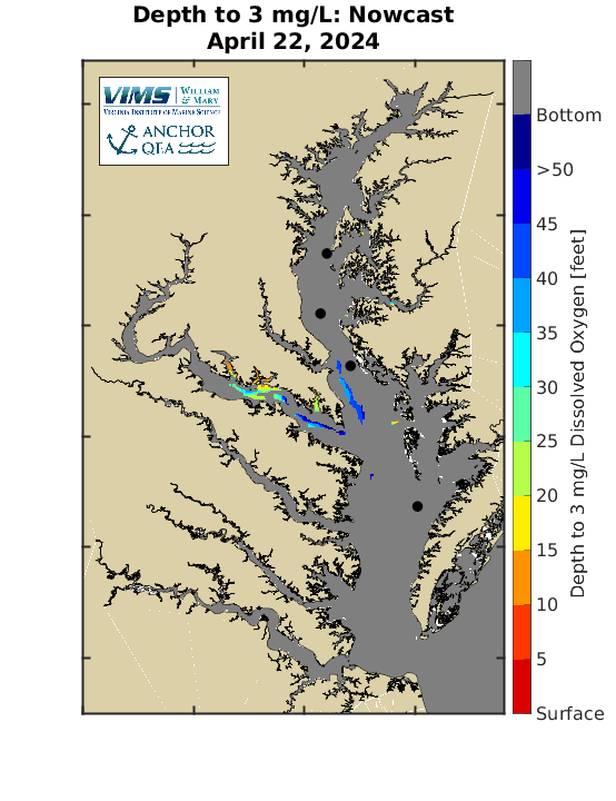
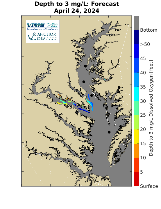
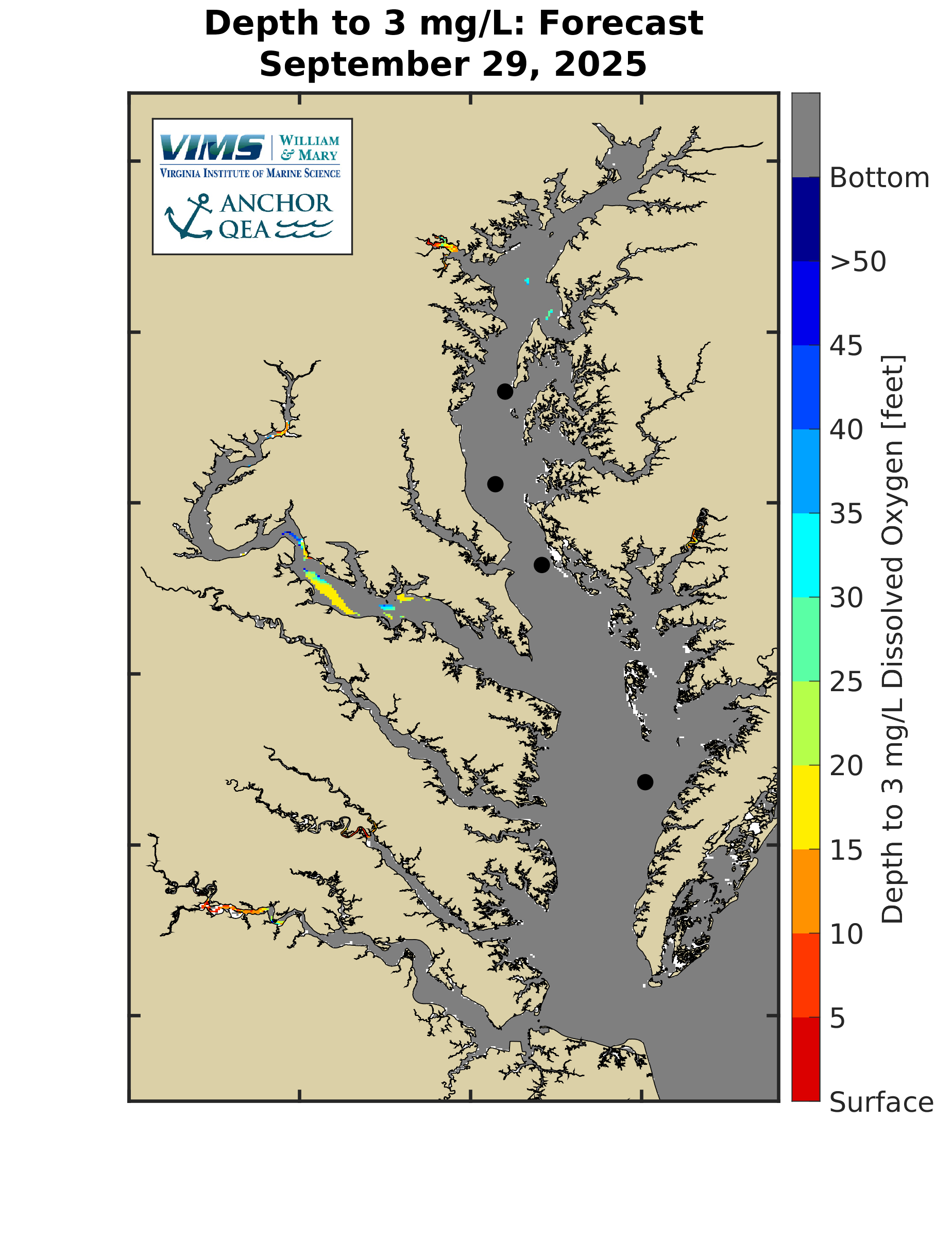
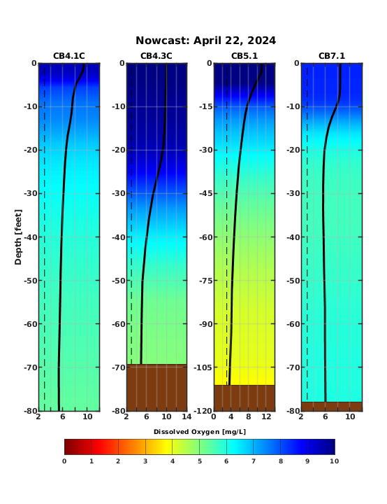
Depth to 3 mg/L Dissolved Oxygen
Quick SummaryFish habitat and productive fishing areas in the Chesapeake Bay are squeezed in the summer by areas of low dissolved oxygen. The Chesapeake Bay Environmental Forecast System is used to visualize this habitat squeeze by estimating the depth below the water surface to a dissolved oxygen concentration of 3 mg/L. Below, maps show the depth in feet to 3 mg/L dissolved oxygen concentration, with gray coloring indicating the dissolved oxygen concentration is greater than 3 mg/L all the way to the bottom. The last image shows vertical profiles of dissolved oxygen at the locations shown with dots on the maps. Vertical profiles progress from CB4.1C in the north to CB7.1 in the south. |
The user assumes the entire risk related to its use of information on Chesapeake Bay Environmental Forecasting System web pages. Information is provided "as is," with no warranties, whether express or implied, including (without limitation) any implied warranties of merchantability or fitness for a particular purpose. In no event will anyone be liable to you or to any third party for any direct, indirect, incidental, consequential, special or exemplary damages or for any claims, losses, damages, costs, expenses and other liabilities, including (but not limited to) reasonable attorneys' fees, whether known or unknown, foreseen or unforeseen, relating to property damage or the death, injury, pain or mental trauma to you, or any other person, which results, directly or indirectly from, or arises out of, any use or misuse of this data.