

Forecast Model Setup
This page summarizes the setup and configuration of the Chesapeake Bay Environmental Forecast System (CBEFS). The below dropdowns can be used to learn about the Regional Ocean Modeling System (ROMS) and Estuarine Carbon Biogeochemisty (ECB) hydrodynamic and ecological models that are the computer model backbone of the forecast system, the model setup and inputs, and the daily forecasting workflow. Acknowledgements and contact information can be found on the Contact Information page.
Summary of ROMS and ECB Computer ModelsThe CBEFS forecast system is based on the ROMS-ECB computer model, which simulates hydrodynamics (water level, currents, salinity, temperature, etc.) and ecology (algal growth and decay, nutrients, dissolved oxygen, etc.). ROMS-ECB is an implementation of the Regional Ocean Modeling System (ROMS, Shchepetkin and McWilliams, 2005) computer model designed for process-based modeling of systems such as the Chesapeake Bay. The ROMS model continues to be expanded and improved, with updates routinely incorporated into the CBEFS implementation. The ECB module is an evolution of Fasham et al. (1990) and also continues to be improved, with various components added over the years. Improvements include the addition of sediment denitrification, carbonate chemistry, bottom resuspension, burial and dissolved organic matter, water-column denitrification, temperature dependence for most biogeochemical processes, atmospheric nitrogen deposition, a dynamic sediment module and inputs from shoreline erosion, and wetting-drying as water levels rise and fall. A detailed documentation of the equations of ECB is available in the supporting information of St-Laurent et al. (2020) while the base code is archived in St-Laurent and Friedrichs (2023). The vast suite of historical data available in the Chesapeake Bay allowed for a careful calibration of ROMS-ECB and permits the model to generate reasonable predictions for a large range of environmental variables. In addition to hydrodynamics and biology, CBEFS also simulates wind waves and swell waves from the open ocean. The Simulated WAves Nearshore (SWAN) model is used for the wave modeling in CBEFS. |
CBEFS Setup and InputsCBEFS is a three-dimensional (3D) model of all of the Chesapeake Bay and the coastal ocean adjacent to the Bay. Being a 3D model, CBEFS simulates both the horizontal (latitude/longitude) and vertical (water depth) dimensions. CBEFS simulates hydrodynamics and biological processes on a 600 meter by 600 meter (2000 ft by 2000 ft) horizontal grid. The vertical dimension is separated into 20 vertical levels. This results in over 1.2 million 3D grid cells in the model. CBEFS simulates 6 days every night. The first day simulated is yesterday using the best-available data for yesterday (termed the Nowcast). CBEFS then simulates the next 5 days as forecasts. CBEFS requires a wide range of inputs to simulate the environmental conditions in the Bay, including riverine freshwater and nutrient inflows, meteorology, tides, and nontidal (storm surge) water levels. Freshwater inflows are based on USGS streamflow gauge data that is scaled based on the Chesapeake Bay Program Phase-6 watershed model and then distributed to more than 70 river and stream inflow locations around the Bay. A simple auto-regressive model based on past streamflows is used to forecast future streamflows. Nutrient inputs (e.g., nitrogen) are estimated using Artificial Neural Network AI models trained to emulate (mimic) the Chesapeake Bay Program Phase-6 watershed model. Meterology (winds, air temperature, etc.) are from the NOAA high-resolution North American Mesoscale weather forecasting model for the first 2.5 days of the forecast and then are from the lower-resolution NOAA Global Forecast System weather forecasting model. Tides in CBEFS are forced using tidal harmonics from the Advanced Circulation (ADCIRC) model. Non-tidal (storm surge or set down) water levels are taken from the NOAA Extratropical Surge and Tide Operational Forecast System (STOFS) model. A simple data-assimilation scheme using NOAA observed water level data ensures the correct water levels at the mouth of the Bay. Temperature and salinity for the model boundary in the Atlantic Ocean are taken from the Rutgers University Doppio forecast model. Nutrients for the model boundary in the Atlantic Ocean are based on long-term monthly climatology (averages) of observed nutrient concentrations. The SWAN wave modeling uses the same meteorology (wind) as the ROMS-ECB hydrodynamic model. Open ocean waves for the model boundary in the Atlantic Ocean are taken from the NOAA Global Forecast System - Wave model. |
CBEFS Daily WorkflowCBEFS is completely automated and runs nightly in the high-performance computing environment at William & Mary and VIMS. Based on a defined schedule, the computer operates independently to run the specific pieces of code to download and processes the necessary inputs, conduct the computer modeling forecasts, and process the model output for dissemination. Between 1:00 AM and 5:30 AM the forecast system retrieves and formats the necessary inputs for the day's forecast as they become available from the source locations. At 5:30 AM the days forecast starts. Wind waves are simulated first because they are needed for the ROMS-ECB forecasts. Following the wave forecasts, a 1-day Nowcast of yesterday is conducted to inform the data assimilation scheme. Any mismatch between modeled and observed water level at the mouth of the Bay is determined and the model water level boundary in the Atlantic Ocean is adjusted to improve the CBEFS simulation. The 1-day Nowcast is then resimulated using the improved water levels and the 5-day forecast is conducted. Following the completion of the computer modeling, additional processing of the model output for dissemination to external partners, viewing forecasts on the VIMS CBEFS webpage, viewing comparisons of CBEFS to observed data, and the sending of any automated alerts is conducted. The automated forecast system then wraps up , with the days forecasts available on the VIMS CBEFS website. Hourly throughout the day, various comparisons of CBEFS to observed data are conducted and the website updated accordingly. Tomorrow, it all starts again. |
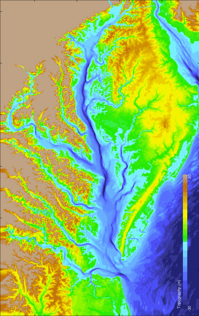
Topography of Chesapeake Bay
Image Copyright: St-Laurent and Friedrichs (2024)